How a map of 125 kofun grew into
431 kofun & two World Heritage sites
The Kofun Explorer Map launched on June 1, 2026 as a small map of about 125 burial mounds. Four months and 400+ updates later, it covers 431 kofun (curated under objective criteria; as of 2026-11-04), the 56 component kofun of two UNESCO World Heritage sites, and 800+ bilingual pages. This page records what got easier — and when.
The Map Today — Main Features
Four months of steady updates add up to this. Tap any card to try the feature.
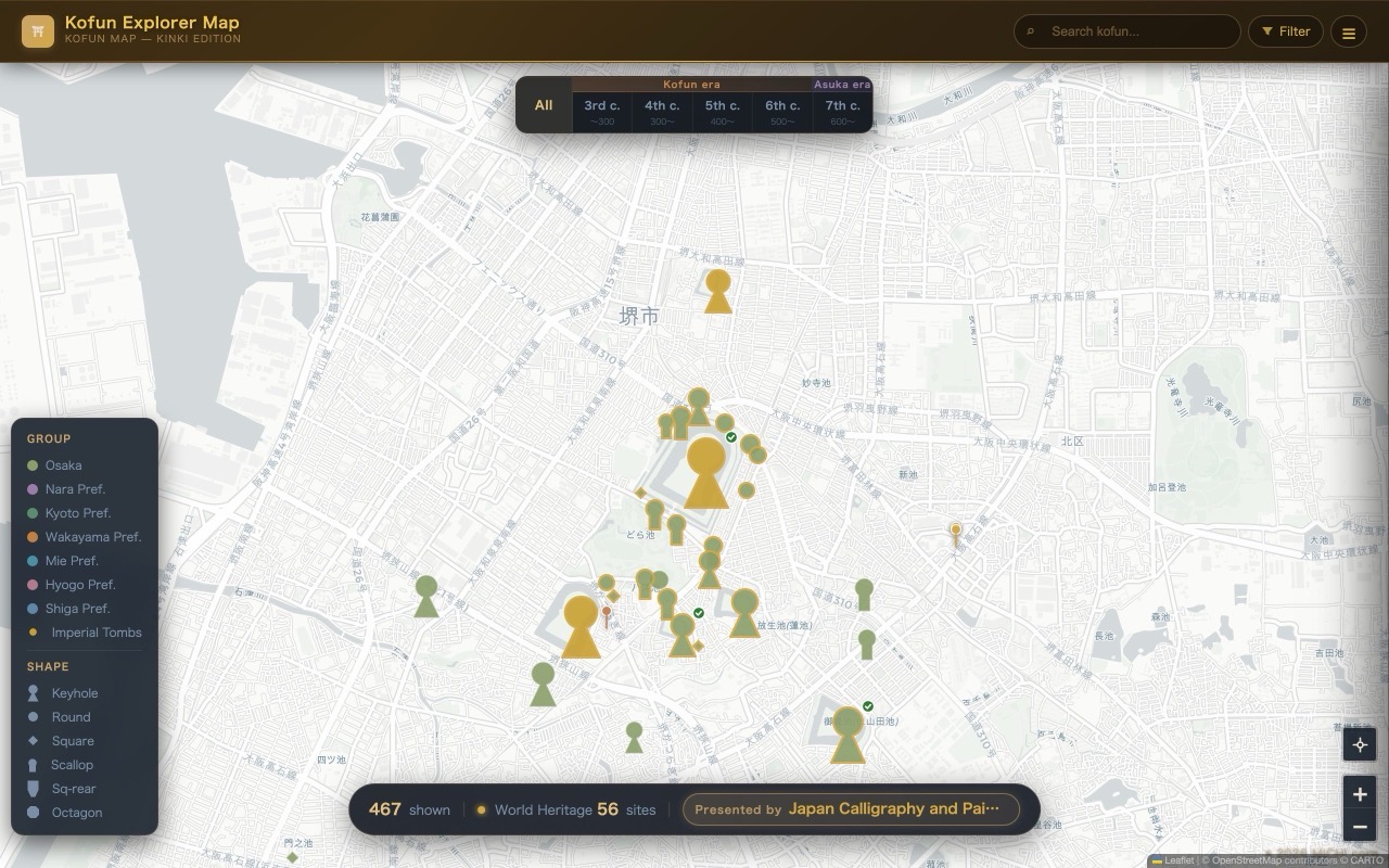 🗾 Interactive map (431 kofun)Marker shapes tell you the mound type — a keyhole for keyhole mounds, a circle for round ones, a diamond for square ones — and a gold ring means World Heritage. Filter by era, shape, prefecture and type.Open the map →
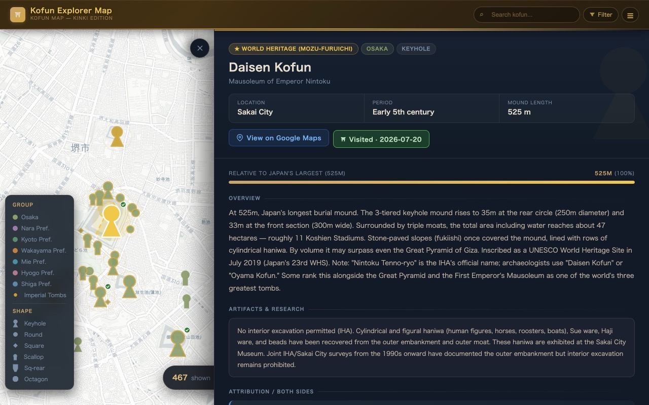 📖 Detail panel + true-scale outlineSelecting a kofun draws its real footprint on the map — "that whole forest is the tomb." Entries keep the official status (IHA attributions and heritage designations) distinct from the archaeological view, with sources.See the Daisen Kofun example →
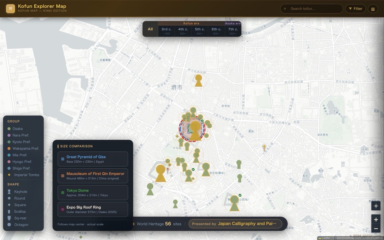 📐 World's-three-great-tombs comparisonOverlay the Great Pyramid of Giza, the First Qin Emperor's mausoleum, Tokyo Dome and the Expo 2025 Grand Ring at true scale — and see why Nintoku's tomb is called the world's largest.From the menu: "Compare" →
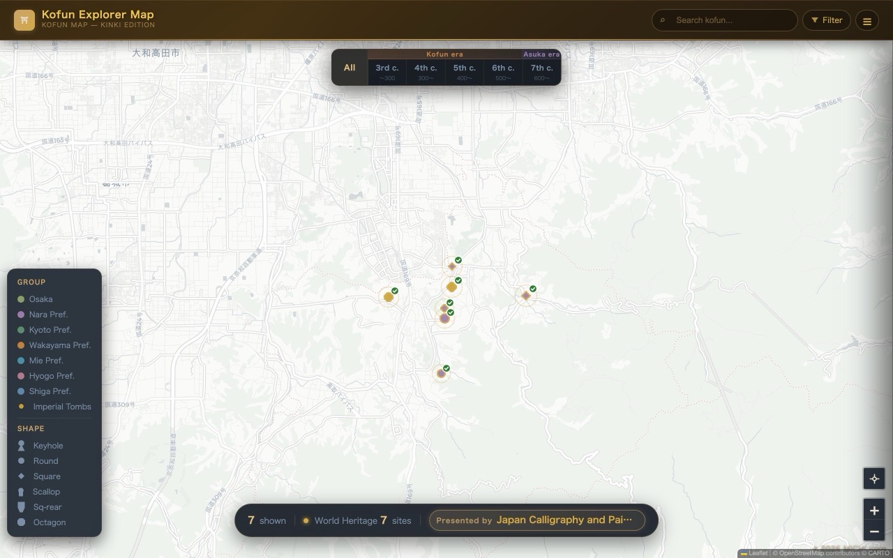 ★ World Heritage filters (2 sites)One tap narrows the map to the 49 Mozu-Furuichi kofun or the 7 of Asuka-Fujiwara — shareable as URLs (?wh=asuka / ?wh=mozu).Show the 7 Asuka-Fujiwara kofun →
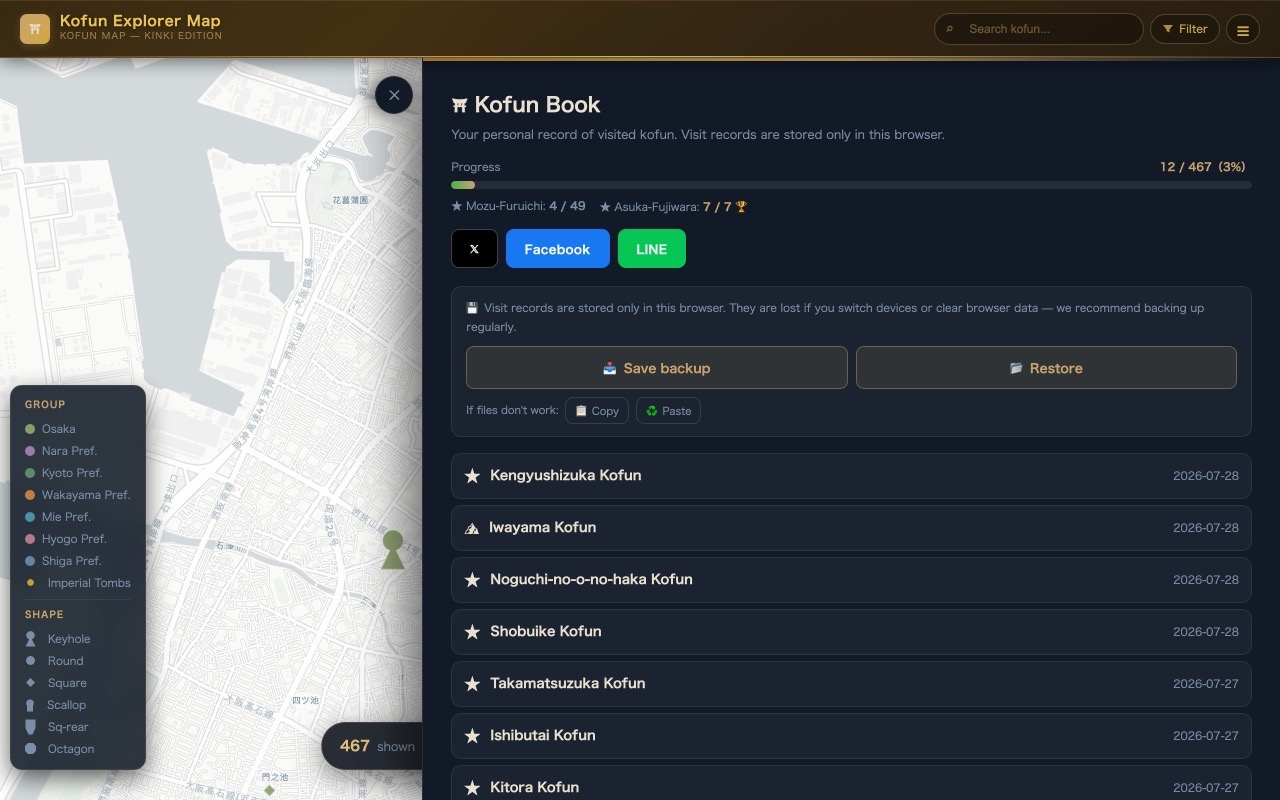 ⛩ Kofun Book (visit log)Record the kofun you visit and track your progress — including completion trophies🏆 for both World Heritage sites, social sharing, and one-tap backup & restore.From the menu: "Kofun Book" →
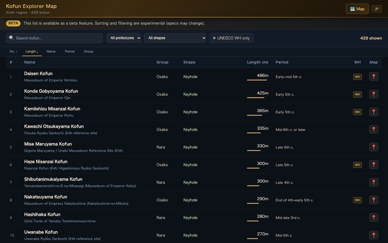 📋 List & sortSort and filter all 431 kofun by name, prefecture, shape, mound length and period, and jump from any row straight to the map or the article page.Open the list →
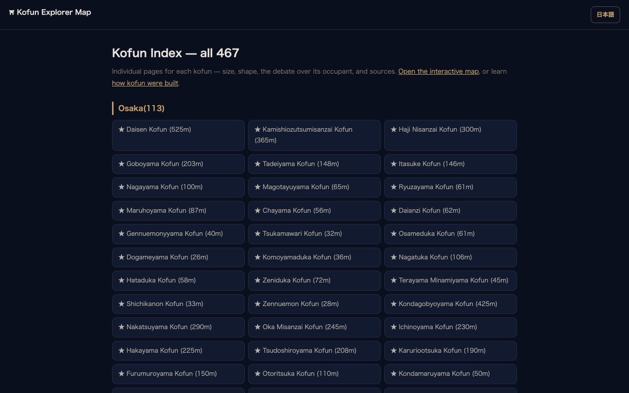 📚 Encyclopedia indexEach of the 431 listed kofun has its own article page — finds, occupant debates, visiting notes — in English and Japanese, with sources.Browse the index →
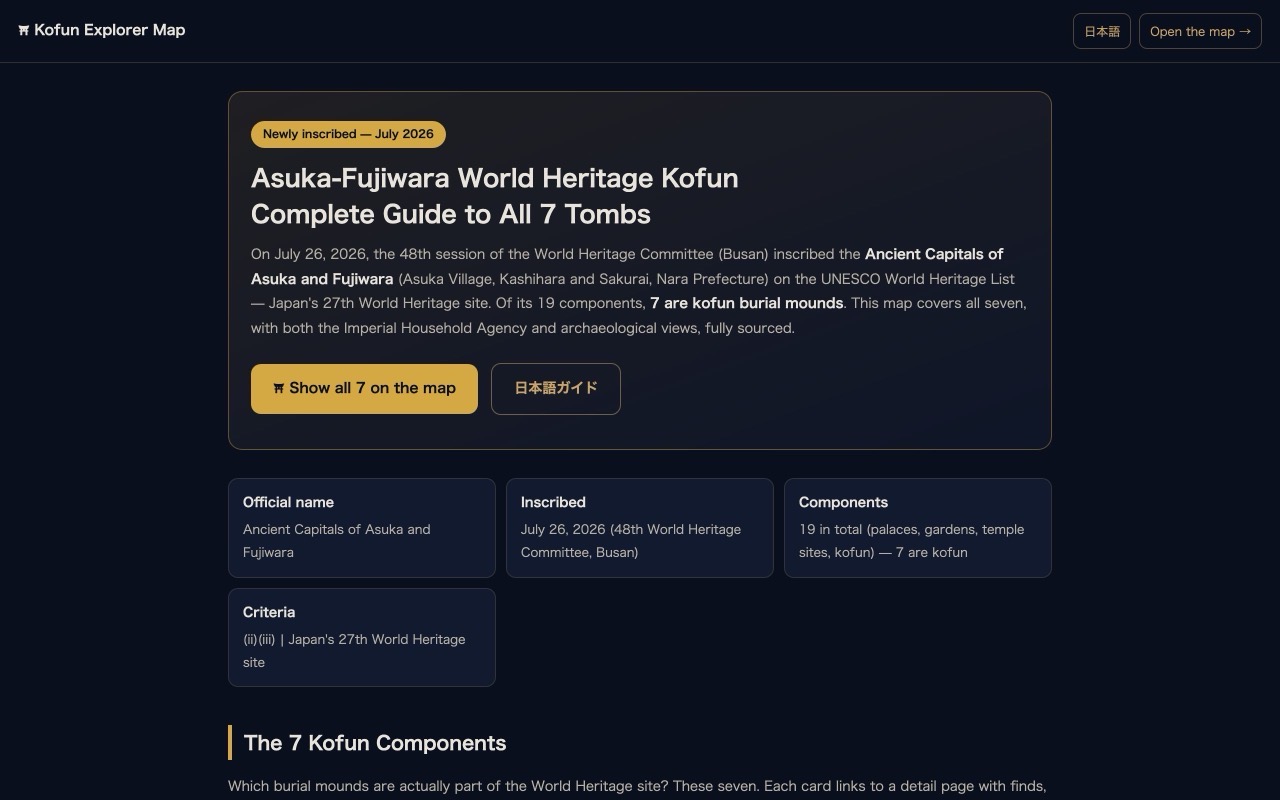 🎉 Special guide: Asuka-Fujiwara (2026)Published three days after inscription. Cards for all 7 kofun components, cycling model courses, and how to enjoy an "invisible heritage" — in Japanese and English.Read the guide →
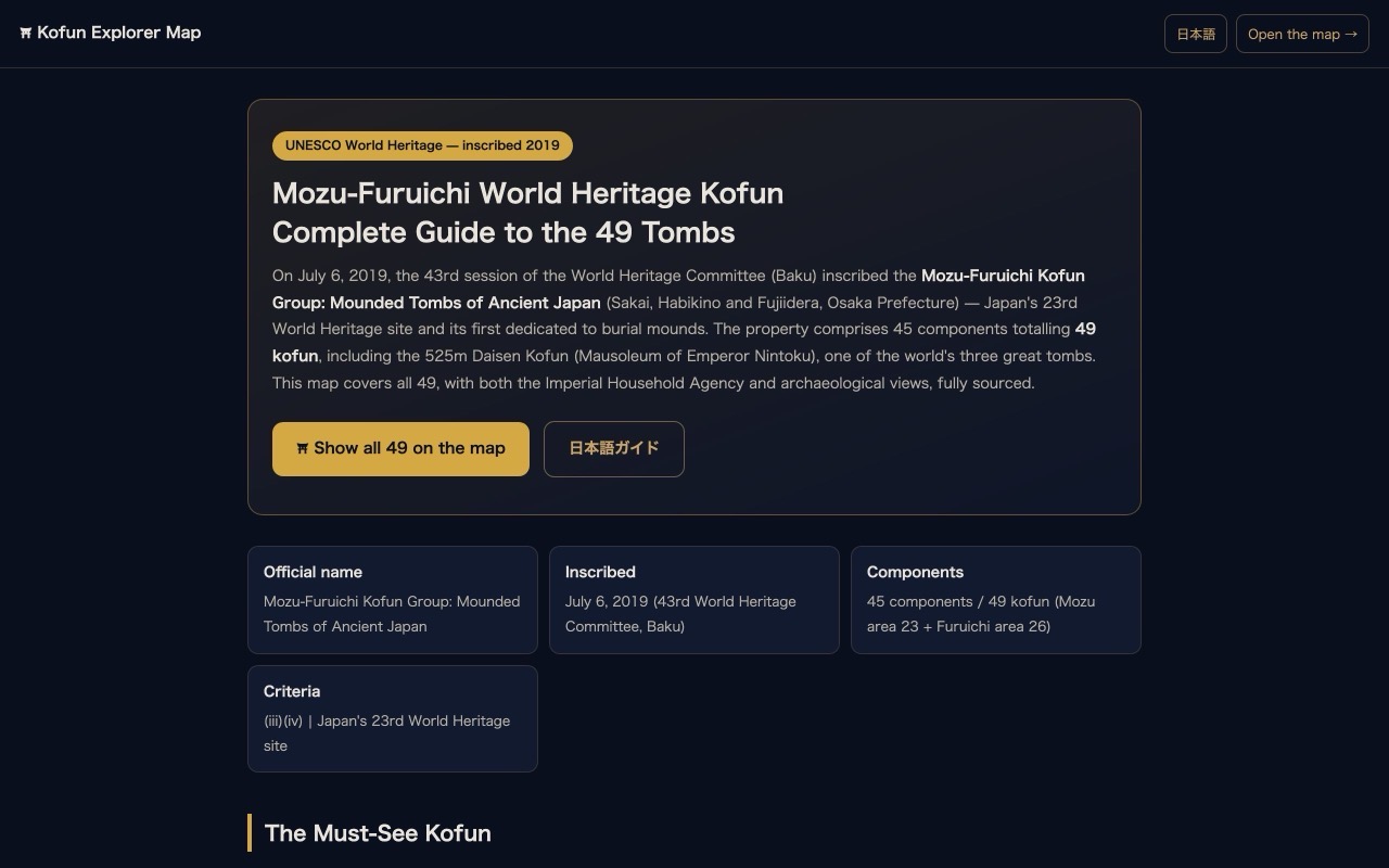 🏛 Special guide: Mozu-Furuichi (2019)The must-see kofun among the 49, viewpoints, how to see tombs "too big to see" (go up, step back, compare), and half-day courses for both areas — in Japanese and English.Read the guide →
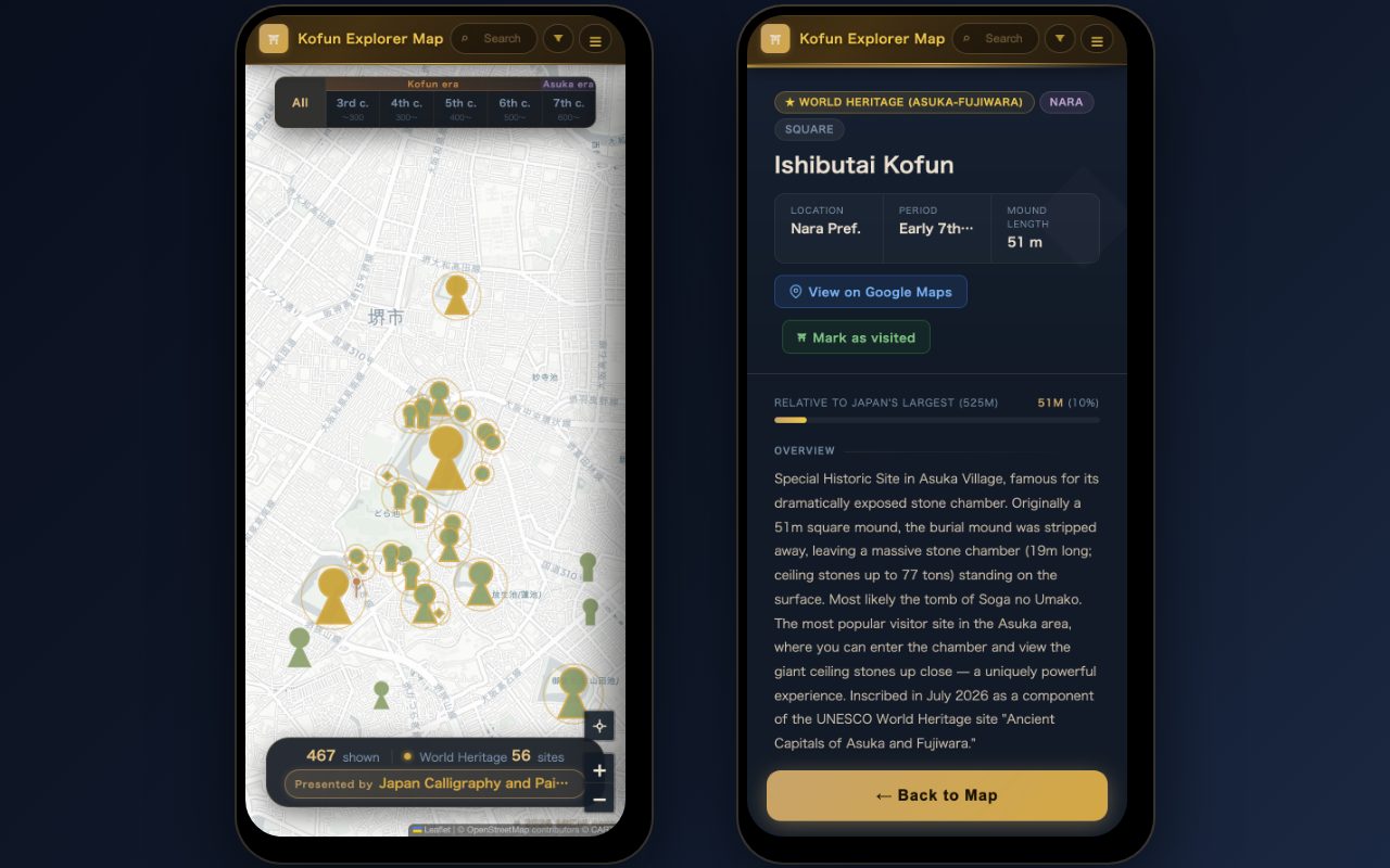 📱 Optimized for phonesA mobile UI built for on-site exploring — thumb-friendly layout, visit-log button, and "Add to Home Screen" for an app-like experience.Open on your phone →
Coverage Over Time — From 125 to 431 Kofun
launchJun 3Jun 5Jun 11Jul 18today
This is a curated map, not an attempt to cover all ~160,000 kofun nationwide: we select those that meet our listing criteria. As a rule we cite two or more independent sources for each kofun; the number of sources and the sources themselves are shown under “Sources” on each kofun's page.
Timeline
⛩ v1.0 launch — about 125 kofun
Born as a bilingual map where clicking a mound opens its story. From launch it promised both the Imperial Household Agency's and archaeologists' views for every entry (revised in October 2026).
🌍 Compare with the world's great tombs at true scale
A comparison overlay added the Great Pyramid and the First Qin Emperor's mausoleum at real size (Tokyo Dome and the Expo Grand Ring came later) — so you can see for yourself why Emperor Nintoku's tomb is called "the world's largest." The haniwa cursor also debuted.
Size comparisonHaniwa cursorSEO groundwork
🔗 kofun-map.com — every kofun gets a shareable URL
Moved to a custom domain on Cloudflare Pages, with ?id=… links that open any kofun directly. "Look at this one" became a single URL. The supporter page and privacy policy also went live.
🗾 Expansion across Kinki — 137 → 289 kofun
Kyoto, Wakayama and Mie joined in one sweep, making it a true map of the Kinki region. The era timeline bar (Kofun / Asuka periods by century) and the sortable list page arrived, and we began adding imperial mausolea more widely.
Kyoto / Wakayama / MieEra filterList page📍 "What's near me right now?"
Current-location display and a nearby-kofun filter — open the map on a trip and the mounds around you appear. Kana search, font-size settings and gold highlighting of the selected marker all landed the same week.
LocationKana searchFont size👑 Imperial mausolea became visitable information
Started adding official Imperial Household Agency visiting details (address, access, hours, where the tomb seals are kept), plus an imperial-tombs filter (access and seal locations are now shown for the 99 sites that have an IHA page). The octagonal-mound marker shape also arrived that day, making terminal-period imperial tombs recognizable at a glance.
IHA visiting infoImperial filterOctagonal mounds🤝 The supporter program began — support engraved on the map
Supporters' names now appear as map pins and a support strip (individual supporters from ¥550/month) — patronage of culture, displayed beside the tombs themselves. Coverage reached 358.
Supporter pinsIndividual supporters📍 Coordinates reviewed in bulk — 333 kofun
The coordinates of 333 kofun were reviewed in one batch using the Google Places API (by 2026-10-17 all coordinates obtained this way had been replaced with values from the Geospatial Information Authority of Japan, Wikipedia, OpenStreetMap and other sources). Selecting a kofun now draws its true-scale footprint outline — "that entire forest is the tomb," made visible.
333 coordinatesTrue-scale outline📖 The Kofun Book and article pages for every kofun
The Kofun Book (visit log) and individual article pages for every kofun (900+ bilingual pages) arrived. We also set the policy of listing shape, size, location and designation only after checking them against two or more independent sources (checking of the data from before then has continued in stages since).
Kofun BookArticle pagesSourcing
✅ Criteria documented & expansion to seven Kinki prefectures — reaching 467
Hyogo and Shiga joined, the selection criteria were published on the site, and coverage of kofun meeting them (imperial mausolea, Special and National Historic Sites, etc.) was extended to seven prefectures. Work began on giving each kofun two or more independent sources (with URLs), and a quality gate now runs five kinds of automated checks on every data update (they check the data format and internal consistency, not whether the content matches history or official sources).
Hyogo / ShigaPublished criteriaQuality gates🎉 Two World Heritage sites — three days after Asuka-Fujiwara's inscription
On July 26 the Ancient Capitals of Asuka and Fujiwara were inscribed. Within three days: World Heritage badges for the 7 kofun components (Ishibutai, Takamatsuzuka, Kitora…), per-site filters, bilingual special guides with model courses for both Asuka-Fujiwara and Mozu-Furuichi, and completion trophies in the Kofun Book.
2 sites / 56 kofun2 special guidesWH completion
🔍 Objective listing criteria & five rounds of source verification — curated down to 427
"Which kofun belong on the map" was pinned to six objective criteria (World Heritage components; IHA-designated mausolea; Special/National Historic Sites and prefectural sites; designated excavated finds; scale such as mounds 80m or longer; groups of 100+ extant mounds), and entries outside them were removed — from 467 down to 427. Entries were checked against primary sources in five rounds (by prefecture, third sources, deep consistency, an overall review, and Japanese–English parity). Where official sources disagree, both figures are shown; unsourced figures were dropped. Each round looked at different items, and errors found since then continue to be corrected. The mausolea of the 1st–124th emperors (some emperors share a mausoleum) are included, matched against the IHA's list of mausolea; each kofun carries a designation badge, and coordinates are being checked against public databases.
6 objective criteria5 verification roundsMausolea of 124 emperors🧭 Two axes: official status and the archaeological view
From launch, every entry carried two cards — an “IHA view” and an “archaeological view.” With 429 entries, more than half of them unrelated to the Imperial Household Agency, we revised the format: IHA attributions and national or local heritage designations are now grouped as “Official status” and shown separately from the “Archaeological view,” with sources. Under each name, IHA mausoleum and tomb names are labeled “Imperial Household Agency:” and other names “Also known as:”.
Official statusArchaeological viewIHA names vs. aliasesListing Criteria — Which Kofun We Include
This is not an attempt to cover all ~160,000 kofun nationwide, but a curated selection: meaningful kofun, presented with their sources. Since September 2026 the criteria are six objective conditions; a kofun is included if it meets any one of them.
- Components of the World Heritage sites "Mozu-Furuichi Kofun Group" (49) and "Asuka-Fujiwara" (7)
- Mausolea, reference sites and satellite tombs designated by the Imperial Household Agency (this category covers the whole country)
- Special Historic Sites, National Historic Sites and prefecture-designated historic sites
- Tombs whose excavated finds are designated cultural properties (National Treasure, Important Cultural Property or prefectural)
- Scale — keyhole-shaped, square-fronted square-backed or scallop-shaped mounds 80m or longer, or round/square mounds 50m or more across
- Large groups of roughly 100 or more extant mounds (shown as one marker at a landmark spot)
Quality standard: as a rule, a new entry's shape, scale, location and designation are checked against two or more independent sources (local governments, the Agency for Cultural Affairs, the Nara National Research Institute for Cultural Properties, Wikipedia, etc.). Where sources disagree, both views are shown; figures we could not confirm are left out. Kofun whose mounds no longer survive are included when academically important, clearly marked as "no longer extant." Errors may still remain — if you spot one, please let us know via the contact on the About page.
These criteria are always available from the map menu under "📋 Selection Criteria."